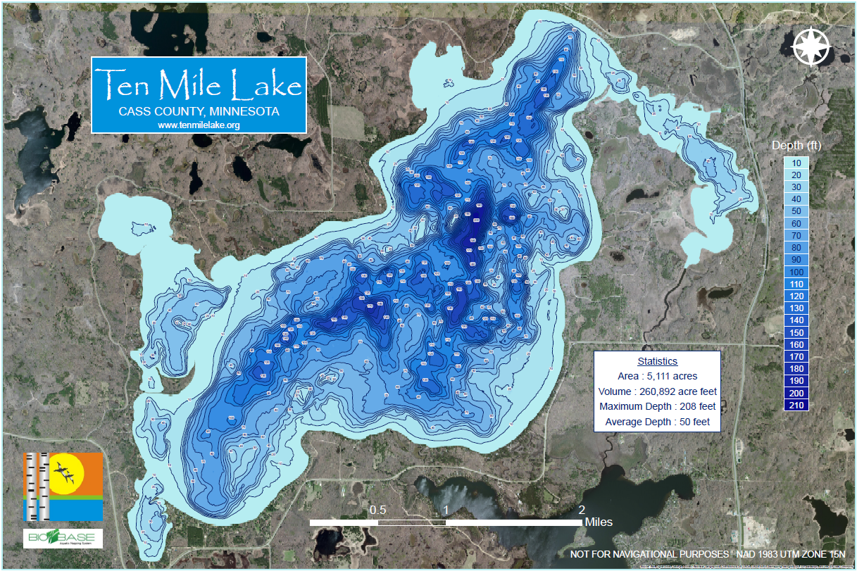
 Click here for larger image of depth map.
To purchase map, contact Bruce Carlson at brcarl@umich.edu
Ten Mile Lake is one of the many Minnesota lakes that owes its origin to the last glacier. Specifically, Ten Mile is a residue of the actions of the Superior lobe of the most recent glacier that covered northeastern Minnesota. As the glacier retreated, it left many depressions in its wake. These depressions became filled with water and formed lakes. One of these depressions created Ten Mile Lake, which may have originated from the gouging and subsequent melting of a huge block of ice. Clues to the origin of the ice from the Lake Superior area are the Ten Mile agates that are the type found in the Lake Superior basin.
Ten Mile is the third deepest lake in Minnesota, with a maximum depth of 209 feet. With a surface area of approximately 5,000 acres, it is considered a medium-size lake in Minnesota. It is a relatively infertile lake, with high water clarity. Secchi disk readings often top out over 21 feet. It is classified as an oligotrophic/mesotrophic lake. Although the main basin overall is very deep, the lake has five shallower bays, which provide excellent habitat for fish and other aquatic animals.
Because of its water clarity, Ten Mile contains abundant aquatic plant life as deep as 30+ feet. The shallower waters contain many of the fish species common to most central Minnesota lakes (e.g. pike, bass, panfish, walleyes and perch). The water below the thermocline is well oxygenated. This allows the presence of a variety of coldwater fish that thrive in deep water, e.g. whitefish, ciscoes, suckers and large pike. A unique feature of Ten Mile is an enormous population (5-8 million) of dwarf ciscoes (4-5” long) that commonly live from 60-100 feet below the surface in water of about 46o. In the evening, the ciscoes follow the migration of plankton toward the surface and then become prey for larger game fish. This rich source of food plays a significant role in the growth of the game fish that prey upon them.
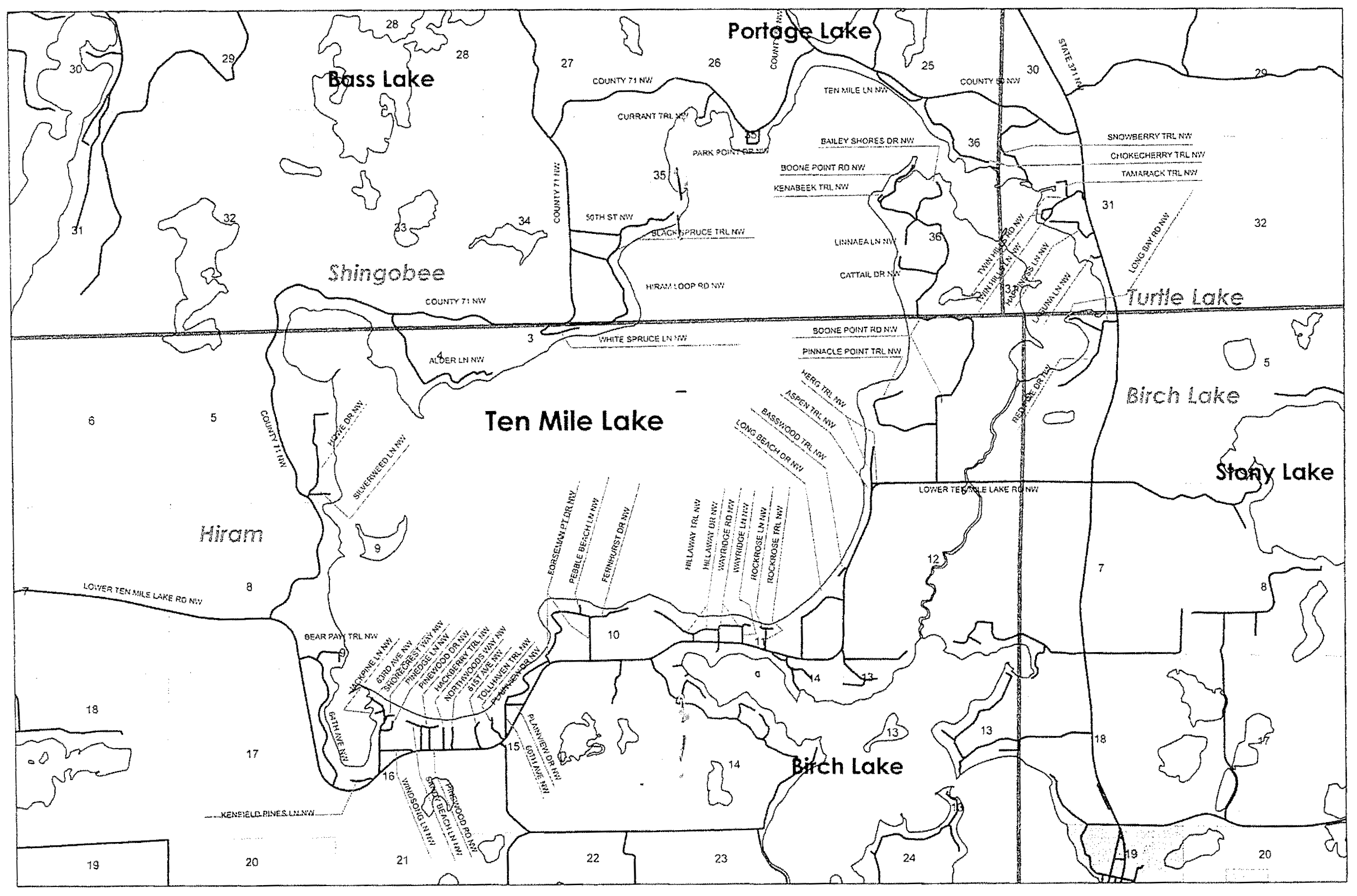
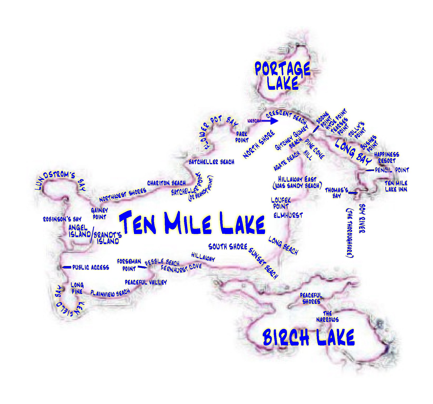
Landmarks
 This map was provided by Geoff Cox. Click on the image to view larger map. Please feel free to send me additional landmark information to be included here!
- Web Cam: Brought to us by Bob Iverson.
- Agate Beach & Pine Cone Hill: “Agate Beach and Pine Cone Hill are located near the Ducharme(sp?) property and was owned by my Aunt Zelda Johnson until it was sold. We used to hike over there and play on the hill and look for agates on the beach. Yes, at one time you used to be able to walk the shore and not get wet. I found an old bass oreno lure there years ago.” – Steve Helscher
- Boone Point: “Boone point was named because when my grandfather bought and plotted the land, he sold it to his friends from Boone, IA. This was during the late teens during the 1900’s. … Across from Boone Point was a cabin owned by the Hyde family [currently Bob Crom’s property]. The family sold the Hyde cabin to my Aunt Zelda Johnson in the early ’60s. The cabin was moved across the ice on wooden rollers and placed on Boone Point. It is still in the family and members of the Hyde family still visit Ten Mile.” – Steve Helscher
- Loufek point: The Loufek’s “bought it from the Caniers who were also from Boone IA.” – Steve Helscher
- Boy River: “…also known as ‘The Thoroughfare’. My grandparents would use it to go to Hackensack to get groceries.” – Steve Helscher
- Thomas’s Bay: “Albert Thomas owned a lot of land in that area of Long Bay. Mom used to get eggs, chickens, etc. there when I was growing up. You can still see some of the out buildings up on the hill. I believe the land belongs to the state or the DNR (not really sure). When mom was growing up, and there during the summer, she and her sisters and the Hyde brothers would use the cattle paths for their walks. The cattle always avoided the swamps somehow.” – Steve Helscher